This is where I can come handy with my drones…..
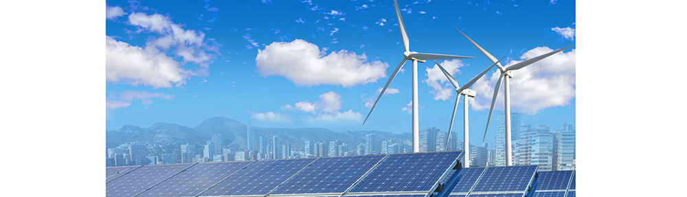
Renewables
Unmanned Aerial Vehicle (UAV) or Drone, as commonly used, are getting increasingly used by the day for the needs of the renewable wind energy industry.
• Maximising health and safety (H&S) – the industry standard method of inspecting turbine blades in a wind farm is to use mobile access platforms or rope access techniques.
• Inspecting functionality of large-scale solar facilities often comes down to thousands of man hours inspecting, identifying and isolating faulty, dirty or shaded solar panels. This extremely lengthy process is expensive to carry out and, although necessary,contributes to a reduction of the profits of solar energy farm.
• Stress fractures or ripples in the metals. They also highlight dents and their depth.
• Stress points in the moving part of the turbine that generate heat (friction) and indicate need of maintenance before breakdown point.
• Defective panels in a solar farm give off more heat than functioning panels and this temperature imbalance can be easily measured by infrared camera.
Surveying
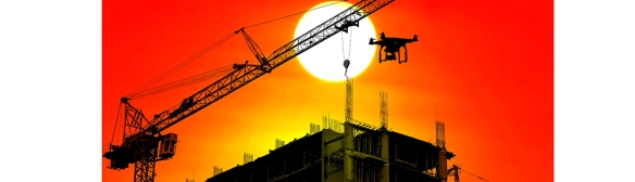
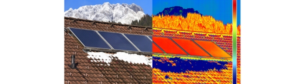 You can use drones to quickly survey your job site and build maps. Instead of using human resources, heavy machinery and expensive surveying tools, that produce complex data, you can get the job done in half the time and money, with greater accuracy. Missing, damaged, or inadequate insulation, building envelope air leaks, moisture intrusion, and substandard work are costly to residential and commercial building owners. By Marcello infrared camera installed on our drones can help you quickly see and find the sources of energy efficiencies, destructive water damage, and structural issues so you can help customers make informed decisions on needed repairs that can help them save energy (£££s) and stay more comfortable.
Environmental monitoring
Drone aerial photography and videography fills a gap between manned aerial inspections and traditional fieldwork, monitoring hard to reach areas, or taking readings in contaminated areas where human health would be at risk. The ability to quickly deploy and capture an area of interest in context, with in-situ measurements,provides an advantage to contamination and reclamation work. The site-specific insight will greatly improve habitat restoration, environmental assessments, monitoring and remediation.By Marcello’s Drone with Thermal and Near infrared sensors provide details of plant health to determine environmental health. Also our Thermal Imaging can help in the area ofenvironment.
Agricultural work
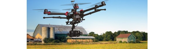
Drone aerial photography can provide farmers with three types of detailed views.
First – seeing a crop from the air can reveal patterns that expose everything from irrigation problems to soil variation and even pest and fungal infestations that aren’t apparent at eye level.
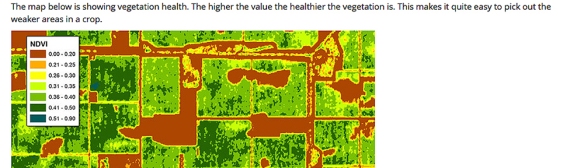
Second – thanks to our Thermal Imaging facilities, airborne cameras can take multispectral images,capturing data from the infrared as well as the visual spectrum, which can be combined to create a view of the crop that highlights differences between healthy and distressed plants in a way that can’t be seen with the naked eye.
Third – our operating low-altitude view (from a few meters above the plants to around 120 meters, which is the regulatory ceiling in the UK imposed by the CAA) gives a perspective that farmers have rarely had before.
Compared with satellite imagery, it’s much cheaper and offers higher resolution. Because it’s taken under the clouds, it’s unobstructed and available anytime. It’s also much cheaper than crop imaging with a manned aircraft, which can run £1,000+ an hour.
With our drone, I can do a precision monitoring of fields, keeping an optimal environment, irrigation conditions and avoid infection. All of this is enabled by using Normalised Difference Vegetation Index images or NDVI, which are extremely detailed and could also help you to measure and monitor plant growth and much more.
Events
Drone Aerial photography and video, from By Marcello aerial photography, can now supply angles and views that were, until now, only accessible using extremely expensive traditional aerial systems (helicopters). Operating safely and efficiently, our aerial cameras provide unique coverage that is unavailable from the ground level. When blended with our “optional” ground level video and photographic capabilities, we produce seamless videos and still images that showcase your organisation’s true spirit.